Marine Exploration
Seismic Studies
We use seismic techniques to capture detailed images of geological layers and assess potential geotechnical structures beneath the seabed.
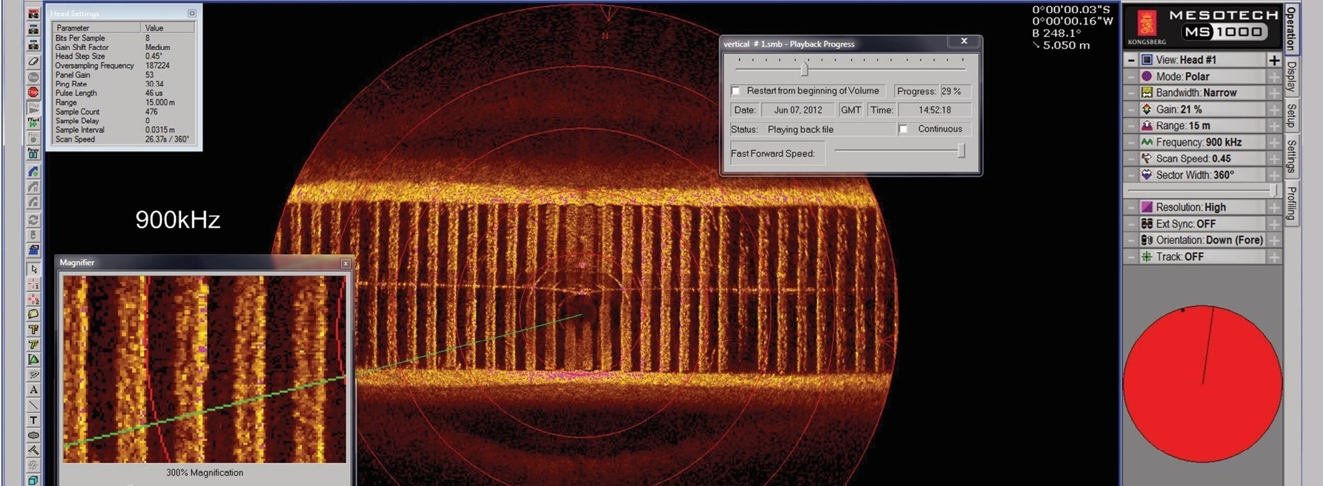
Underwater Inspection with Mesotech Sonar
This advanced survey technology is essential for high-precision underwater mapping. It produces high-resolution images and is ideal for challenging conditions, such as low visibility or restricted access areas.
Underwater Inspection with ROV
Geotechnical Studies
Analyze and evaluate the mechanical and physical properties of seabed sediments and rocks, providing essential data for marine engineering and exploration.
Marine Geophysical Surveys
We explore the seabed and underlying geological layers to analyze the Earth's structure, composition, and dynamics, providing critical data for marine and environmental research.
Underwater Solutions
Marine Exploration
At PosicionamientosMarinos Malaquías, we specialize in marine exploration, offering advanced mapping services and seabed studies.
Contact us to learn more about our integrated underwater solutions, tailored to meet the needs of your project.
Marine Geophysical Surveys

At MalaquíasSubsea, we specialize in conducting marine geophysical studies, investigating the seabed and the underlying geological layers beneath the oceans to gather critical information on the Earth's structure, composition, and dynamics. This data is vital for making informed decisions in our clients projects.
We employ a range of advanced geophysical techniques to analyze the physical properties of seabed rocks and sediments. Our studies are essential in various fields, including geology, oceanography, natural resource exploration (oil, gas, minerals), andthe assessment of geological risks (earthquakes, tsunamis, submarine landslides).
Some of the key techniques employed in marine geophysical studies include:
Marine Seismology
Through the emission of seismic waves in water and their reflection or refraction across subsurface layers, marine seismology allows for detailed mapping of the seabed's structure.
Marine Magnetometry
This technique measures variations in the Earth's magnetic field to detect changes in the composition and structure of underwater rocks.
Marine Gravimetry
This technique measures subtle variations in gravity at the sea surface, enabling the detection of density anomalies beneath the seabed.
Electromagnetic Methods
These methods measure the electrical conductivity of the seabed, providing valuable insights for identifying resources such as oil and minerals.
These studies are crucial for exploring underwater natural resources and gaining a deeper understanding of the geological and tectonic processes occurring in the ocean depths.
Marine Geotechnical Studies

At MalaquíasSubsea, we conduct marine geotechnical studies that focus on analyzing and evaluating the mechanical and physical properties of seabed sediments and rocks. These studies are vital for coastal and marine engineering projects, including the construction of oil platforms, offshore wind farms, bridges, submarine pipelines, and other offshore infrastructure.
Marine Geotechnical Studies
The primary goal of marine geotechnical surveys is to verify that the subsea terrain can support planned structures and to assess potential risks, such as submarine landslides, soil liquefaction, or subsidence. For more information, check out our latest blog article.
Seabed inspection with Mesotech Sonar

At MalaquíasSubsea, we offer seabed inspection services using Circular Scan Sonar, a high-precision underwater research and mapping tool developed by Kongsberg Mesotech.
Mesotech Sonar
Sonars ystems are extensively used in a variety of applications, including underwater exploration, infrastructure inspection, geological surveys, and search and rescue operations.
Underwater Inspection with ROV

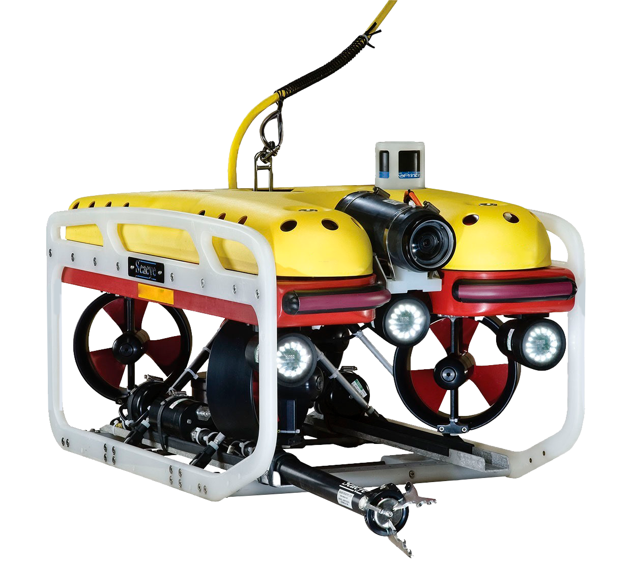
Malaquías Subsea offers Underwater Inspection services with ROVs (Remotely Operated Vehicles), an advanced technique for exploring and monitoring the seabed using unmanned underwater vehicles, controlled remotely from the surface.
ROV Equipment
ROVs are equipped with video cameras, sonars, and various measuring instruments, enabling detailed data collection of the underwater environment without the need for human immersion. This makes them ideal for areas with difficult access or hazardous conditions.

Cámara de Monitoreo UHD
Luz LED
Propulsores
Brazo Robótico
Flotadores / Estabilizadores
Cadena umbilical de fibra óptica
Sonar
